
Novar 1 Repowering
55.8MW
Combined generating capacity
151,041MWh
Estimated annual generation
45,453households
Equivalent to approximate annual consumption
65,835t/year
CO2 avoided
(compared to energy produced with coal)
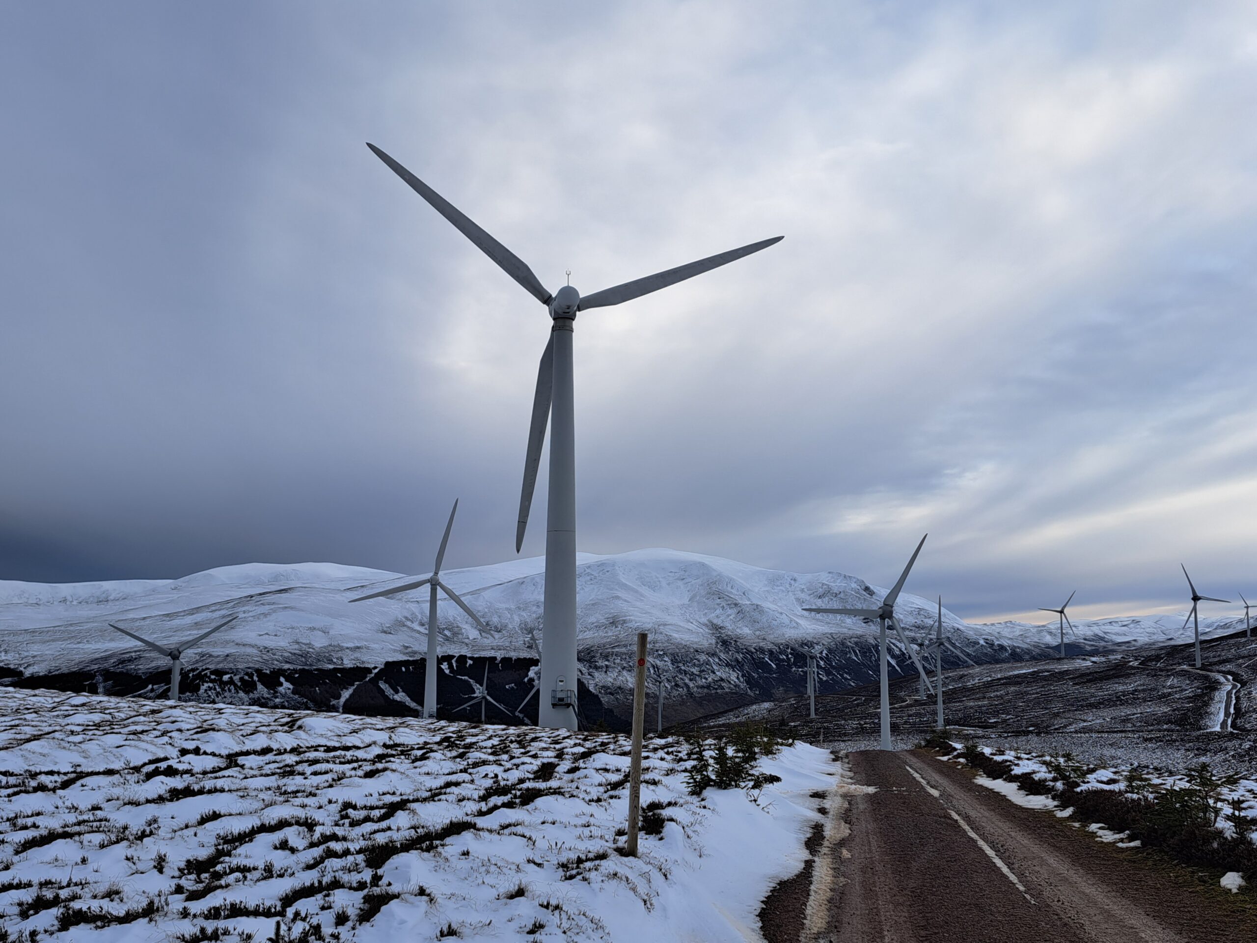
Novar Wind Farm sits in a picturesque Highland location approximately 5.5 miles west of Alness. From its elevated position on an extensive Easter Ross shooting estate it enjoys commanding views of the Cromarty Firth and Ben Wyvis.
As well as being steeped in the history of Scotland's Highland clans, the area is well known for its contribution to Highland employment with a number of light and heavy industries based locally. The yards at Invergordon and Nigg play a significant role in offshore development in the oil and gas sectors and, more recently, have been heavily involved in fabrication for renewables including offshore wind farms.
Novar was built in 1997 and its 34 turbines are rated at 500kW giving the site has an installed capacity of 17MW, generating enough energy to power 14,027 homes.
Repowering Project
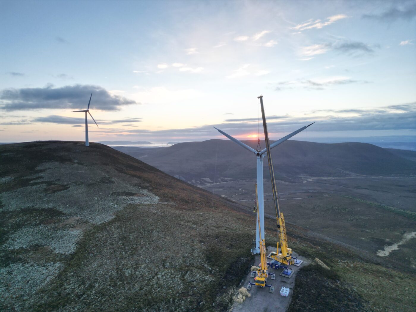
As it becomes vital to combat climate change by producing more electricity from renewable sources, allowing fossil fuels to be phased out, we are proposing to repower the wind farm. Our proposal is for up to 9 wind turbines with an installed capacity of approximately 6.2 MW each which will replace the existing 34 turbines.
This would bring the total installed capacity of the wind farm up to around 55.8 MW, helping to meet the Scottish Government’s targets for reducing emissions of greenhouses gases and powering Scotland with renewable energy.
We have now submitted a planning application to repower Novar 1 Wind Farm, full details of which can be found on the Planning Application page of this website.
- Located in Easter Ross, near Evanton
- Up to 9 wind turbines replacing the existing 34
- Will include associated infrastructure – internal access roads, onsite substations, borrow pits
- Will provide local community benefit funding
- Extensive environmental and ornithology surveys underway
- Public exhibitions will be carried out to share the plans with local communities and gather their feedback
- As the combined installed capacity of the wind farm will be over 50MW, our planning application will be made under Section 36 of the Electricity Act (1996) and will be determined by Scottish Government Ministers
Project benefits
At our wind farms we invite the local community to help us shape a community benefit package that best meets local needs and wishes.
If the project receives planning consent, we will provide a community benefit package of £5,000 per installed MW per annum and this will be delivered in partnership with local stakeholders to help ensure the funding delivers the maximum benefit.
Nadara is committed to investigating the opportunity for a shared ownership scheme to be provided at Novar and will continue to engage with communities and stakeholders about the scope of the community benefit package post submission of the repowering planning application.
Project updates
- 10 Nov 2026
Planning Application
A planning application to repower Novar Wind 1 Wind Farm has now been submitted to the Energy Consents Unit. The planning application reference number is ECU00006087.
The application comprises the following documents, which can be downloaded below.
- Environmental Impact Assessment Report (EIAR):
- Volume 1: Non-Technical Summary (NTS)
- Volume 2: Main Report
- Volume 3a: Figures
- Volume 3b: NatureScot visualisations
- Volume 3c: THC visualisations
- Volume 4: Technical Appendices
- Volume 5: Confidential Appendices
- Supplementary documents
Paper copies of the EIAR are be available at the following locations:
- Cornerstone Café, 16 Balconie Street, Evanton, IV16 9UN
(Opening hours: Tuesday to Thursday: 10:00 – 14:00) - Alness Library, Averon Leisure Centre, High Street, IV17 0QB
(Opening hours: Monday to Thursday: 08:00 – 22:00; 08:00-21:00 Friday; 09:00 – 14:00 Saturday) - The Highland Council Dingwall office, 84 High Street, Dingwall, IV15 9QN
(Monday, Wednesday and Friday: 09:30 – 12:30; Tuesday and Thursday: 09.30 – 12.30 and 13:30 – 16:00)
The application documents are available on the Scottish Government Energy Consents portal (ref: ECU00006087) (https://www.energyconsents.scot/Default.aspx).
We would like thank everyone who has engaged in the project development process and look forward to ongoing dialogue.
- Environmental Impact Assessment Report (EIAR):
- 27 Aug 2025
Public Exhibition 27 & 28 August 2025
To find out more about our public exhibition, view the pdf files below:
- 4 Mar 2025
Public Exhibitions 4 & 5 March 2025
To find out more about our first public exhibition, view the PDF below.
Novar 1 Repowering Application Documents
-
Volume 2 Contents
-
Chapter 1 Introduction
-
Chapter 2 EIA Methodology and Scope
-
Chapter 3 Site Description and Proposed Development
-
Chapter 4 Design Evolution and Alternatives
-
Chapter 5 Landscape and Visual
-
Chapter 6 Cultural Heritage
-
Chapter 7 Ecology
-
Chapter 8 Ornithology
-
Chapter 9 Hydrology Hydrogeology and Soils
-
Chapter 10 Noise
-
Chapter 11 Traffic and Access
-
Chapter 12 Aviation
-
Chapter 13 Cumulative Effects
-
Chapter 14 Summary of Residual Effects
-
Environmental Impact Assessment Report EIAR Volume 2 Main Report Glossary and Abbreviations
-
Volume 2 Contents
-
Volume 3a Contents
-
Figure 1 1 Site Location
-
Figure 1 2 Existing Novar Wind Farm Layout
-
Figure 1 3a Proposed Site Layout
-
Figure 1 3b Proposed Site Layout
-
Figure 2 2 Cumulative Developments
-
Figure 2 1 Shadow Flicker Study Area and Receptors
-
Figure 3 1 Environmental Designations
-
Figure 3 2 Typical Turbine Elevation
-
Figure 3 3 Typical Turbine Foundation
-
Figure 3 4 Typical Turbine Hardstanding
-
Figure 3 5 Typical Existing Road Widening
-
Figure 3 6 Typical Track
-
Figure 3 7 Typical Watercourse Crossing Methods
-
Figure 3 8 Indicative Construction Compound 1
-
Figure 3 9 Indicative Construction Compound 2
-
Figure 3 10 Indicative Construction Compound 3
-
Figure 3 11 Indicative Substation Compound
-
Figure 3 12 Proposed Access Junction
-
Figure 3 13 Proposed Access Junction Visibility
-
Figure 3 14 Typical Cable Trench
-
Figure 4 1 Design Iteration
-
Figure 5 1 Location Plan and LVIA Study Area
-
Figure 5 2 Topography
-
Figure 5 3 Landscape Character
-
Figure 5 4 Landscape Character and Zone of Theoretical Visibility
-
Figure 5 5 Zone of Theoretical Visibility Bare Ground Comparative Tip Height
-
Figure 5 6 Zone of Theoretical Visibility Bare Ground Tip Height
-
Figure 5 7 Zone of Theoretical Visibility Bare Ground Hub Height
-
Figure 5 8a Visual Receptors and Tip Height Zone of Theoretical Visibility
-
Figure 5 8b Visual Receptors and Tip Height Zone of Theoretical Visibility
-
Figure 5 9 Landscape Designations and Wild Land Areas with Tip Height Bare Ground ZTV
-
Figure 5 10 Comparative Zone of Theoretical Visibility and Wildland Area
-
Figure 5 11 Relative Wildness and Wildland Area
-
Figure 5 12 Tip Height Zone of Theoretical Visibility and Wildland Area
-
Figure 5 13 Cumulative Location Plan
-
Figure 5 14 Cumulative Zone of Theoretical Visibility ZTV Novar Repower with Operational Sites
-
Figure 5 15 Cumulative Zone of Theoretical Visibility ZTV Novar Repower with Consented Sites
-
Figure 5 16 Cumulative Zone of Theoretical Visibility ZTV Novar Repower with Abhainn Dubh in Planning
-
Figure 5 17 Cumulative Zone of Theoretical Visibility ZTV Novar Repower with Carn Fearna in Planning
-
Figure 5 18 Cumulative Zone of Theoretical Visibility ZTV Novar Repower with Ballach in Planning
-
Figure 5 19 Cumulative Zone of Theoretical Visibility ZTV Novar Repower with Balblair and Lairg 3 in Planning
-
Figure 5 20 Cumulative Zone of Theoretical Visibility ZTV Novar Repower with Achany Ext Allt an Tuir Strath Oykel Coille Beith in Planning
-
Figure 5 21 Cumulative Zone of Theoretical Visibility ZTV Novar Repower with Ceislein In Planning
-
Figure 5 22 Cumulative Zone of Theoretical Visibility ZTV Novar Repower with Creachan In Planning
-
Figure 5 23 Cumulative Zone of Theoretical Visibility ZTV Novar Repower with BTRP Scoping
-
Figure 5 24 Cumulative Zone of Theoretical Visibility ZTV Novar Repower with Glasa Scoping
-
Figure 5 25 Cumulative Zone of Theoretical Visibility ZTV Novar and Tarvie Wind Farm Scoping
-
Figures 6 1a Non designated Heritage Assets and Events within Site and 1 km Study Area
-
Figures 6 1b Non designated Heritage Assets and Events within Site and 1 km Study Area
-
Figures 6 1c Non designated Heritage Assets and Events within Site and 1 km Study Area
-
Figures 6 1d Non designated Heritage Assets and Events within Site and 1 km Study Area
-
Figures 6 1e Non designated Heritage Assets and Events within Site and 1 km Study Area
-
Figures 6 1f Non designated Heritage Assets and Events within Site and 1 km Study Area
-
Figure 6 2 Designated Heritage Assets within 1 km and 5 km Study Areas
-
Figure 6 3 Designated Heritage Assets within 10 km Study Area and Selected Designated Heritage Assets beyond 10 km Study Area
-
Figure 6 4 Extract from a Map by Blaeu 1654
-
Figure 6 5 Extract from a Map by Roy 1747 1752
-
Figure 6 6 Composite of Extracts from Ordnance Survey maps 1881
-
Figure 6 7 Composite of Extracts from Ordnance Survey maps 1959 1970
-
Figures 6 8a Designated Heritage Assets and Proposed Cultural Heritage Visualisation Viewpoints V Ps
-
Figures 6 8b Designated Heritage Assets within 10 km Study Area with Selected Assets beyond 10 km ZTV and Proposed CH V Ps
-
Figure 7 1 Designated Sites
-
Figure 7 2 UK Hab Habitat Survey Results
-
Figure 7 3 National Vegetation Classifications Survey Results
-
Figure 7 4 Potential Groundwater Dependent Terrestrial Ecosystems
-
Figure 7 5 Target Notes
-
Figure 7 6 Bat Detector Locations
-
Figure 7 7 Areas Available for Peat Restoration
-
Figure 8 1 Ornithology Designated Sites 20km
-
Figure 8 2 Ornithology Flight Activity Survey Locations
-
Figure 8 4b Vantage Point Survey Results 2023 2025 Red Kite
-
Figure 8 4c Vantage Point Survey Results 2023 2025 Other Target Species
-
Figure 8 5 Moorland Breeding Bird Survey Results 2024
-
Figure 8 9 Collision Risk Areas Collision Risk Assessment TA
-
Figure 9 1 Surface Water Features
-
Figure 9 2 Drinking Water Protected Areas Water Resources
-
Figure 9 3 625 K Superficial Geology
-
Figure 9 4 625 K Bedrock Geology
-
Figure 9 5 625 K Hydrogeology
-
Figure 9 6 National Vegetation Classifications NVC Groundwater Dependent Terrestrial Ecosystem GWDTE Classification
-
Figure 9 7 Groundwater Dependent Terrestrial Ecosystem GWDTE Assessment
-
Figure 9 8 Peat Depths
-
Figure 9 9 SNH Carbon and Peatland Map 2016 Extract
-
Figure 9 10 Proposed Borrow Pit Locations
-
Figure 10 1 Noise prediction contours
-
Figure 11 1 Study Area
-
Figure 11 2 Traffic Count Location Plan
-
Figure 11 3 Personal Injury Accident Plan
-
Figure 11 4 Abnormal Indivisible Loads AIL Delivery Route
-
Volume 3a Contents
-
Volume 3b Contents
-
Figure 6 10a f Cultural Heritage Viewpoint 2 Drumore farmstead field system chambered cairn cupmarks 600m W of SM4945 Asset 13
-
Figure 6 9a f Cultural Heritage Viewpoint 1 Carn na Feinne chambered cairn SM4812 Asset 2
-
Figure 6 11a f Cultural Heritage Viewpoint 3 Boath three chambered cairns NE and NNE of Easter Ballone Farm SM6644 Assets 17 1 17 3
-
Figure 6 12a f Cultural Heritage Viewpoint 4 Wyvis Lodge LB7906 Asset 23 1 Cultural Heritage VP 4
-
Figure 6 13a f Cultural Heritage Viewpoint 5 Ardross Castle Entrance LB15031 Asset 26 1
-
Figure 6 14a f Cultural Heritage Viewpoint 6 Ardross Castle Terrace LB15031 Asset 26 1
-
Figure 6 15a f Cultural Heritage Viewpoint 7 Ardross Castle GDL00023 Asset 31
-
Figure 6 16a f Cultural Heritage Viewpoint 8 Glenurquhart long cairn 800m NW of SM4671 Asset 129
-
Figure 6 17a f Cultural Heritage Viewpoint 9 Easter Brae long cairn cairn SM2457 Asset 132
-
Figure 6 18a e Cultural Heritage Viewpoint 10 Balnacrae chambered cairn 230m SWS of SM2396 Asset 20
-
Figure 6 19a f Cultural Heritage Viewpoint 11 Easter Baldoon chambered cairn 190m NNE of SM4753 Asset 7
-
Figure 6 20a e Cultural Heritage Viewpoint 12 Stittenham House chambered cairn 135m W of SM4700 Asset 1
-
Figure 6 21a e Cultural Heritage Viewpoint 13 Carn na Croiche chambered cairn SM4750 Asset 5
-
Figure 6 22a f Cultural Heritage Viewpoint 14 Eileanach Lodge settlement field system 550m WSW of SM4707 Asset 11
-
EIAR Volume 3b Nature Scot Visualisation Figure 5 41a g Viewpoint 16 Ben Wyvis Lower Summit of An t Socac
-
EIAR Volume 3b Nature Scot Visualisation Figure 5 41h i Viewpoint 16 Ben Wyvis Lower Summit of An t Socac
-
Environmental Impact Assessment Report EIAR Volume 3b Nature Scot Visualisation Figure 5 26a g Viewpoint 1 Beinn Dearg
-
Environmental Impact Assessment Report EIAR Volume 3b Nature Scot Visualisation Figure 5 27a g Viewpoint 2 Carn Salachaidh
-
Environmental Impact Assessment Report EIAR Volume 3b Nature Scot Visualisation Figure 5 28a i Viewpoint 3 Loch Glass by W
-
Environmental Impact Assessment Report EIAR Volume 3b Nature Scot Visualisation Figure 5 29a i Viewpoint 4 Strath Rusdale
-
Environmental Impact Assessment Report EIAR Volume 3b Nature Scot Visualisation Figure 5 30a g Viewpoint 5 A9 between Dunca
-
Environmental Impact Assessment Report EIAR Volume 3b Nature Scot Visualisation Figure 5 31a g Viewpoint 6 Boath
-
Environmental Impact Assessment Report EIAR Volume 3b Nature Scot Visualisation Figure 5 32a i Viewpoint 7 Minor Road at In
-
Environmental Impact Assessment Report EIAR Volume 3b Nature Scot Visualisation Figure 5 33a g Viewpoint 8 Minor Road by Ar
-
Environmental Impact Assessment Report EIAR Volume 3b Nature Scot Visualisation Figure 5 34a g Viewpoint 9 Loch Morie
-
Environmental Impact Assessment Report EIAR Volume 3b Nature Scot Visualisation Figure 5 35a g Viewpoint 10 Summit of Beinn
-
Environmental Impact Assessment Report EIAR Volume 3b Nature Scot Visualisation Figure 5 36a f Viewpoint 11 Summit of Cnoc
-
Environmental Impact Assessment Report EIAR Volume 3b Nature Scot Visualisation Figure 5 37a g Viewpoint 12 Cromarty Black
-
Environmental Impact Assessment Report EIAR Volume 3b Nature Scot Visualisation Figure 5 38a g Viewpoint 13 Easter Brae Bl
-
Environmental Impact Assessment Report EIAR Volume 3b Nature Scot Visualisation Figure 5 39a f Viewpoint 14 Dornoch Point
-
Environmental Impact Assessment Report EIAR Volume 3b Nature Scot Visualisation Figure 5 40a f Viewpoint 15 Dornoch Firth B
-
Environmental Impact Assessment Report EIAR Volume 3b Nature Scot Visualisation Figure 5 42a g Viewpoint 17 A835 at Leanaig
-
Environmental Impact Assessment Report EIAR Volume 3b Nature Scot Visualisation Figure 5 43a g Viewpoint 18 B9039 approach
-
Environmental Impact Assessment Report EIAR Volume 3b Nature Scot Visualisation Figure 5 44a g Viewpoint 19 Culbokie Black
-
Environmental Impact Assessment Report EIAR Volume 3b Nature Scot Visualisation Figure 5 45a h Viewpoint 20 Glen Glass
-
Environmental Impact Assessment Report EIAR Volume 3b Nature Scot Visualisation Figure 5 46a g Viewpoint 21 A817 Invergord
-
Environmental Impact Assessment Report EIAR Volume 3b Nature Scot Visualisation Figure 5 47a g Viewpoint 22 Tom Ban Mor
-
Environmental Impact Assessment Report EIAR Volume 3b Nature Scot Visualisation Figure 5 48a g Viewpoint 23 Diebidale Ridge
-
Environmental Impact Assessment Report EIAR Volume 3b Nature Scot Visualisation Figure 5 49a g Viewpoint 24 Knockfarrel
-
Environmental Impact Assessment Report EIAR Volume 3b Nature Scot Visualisation Figure 5 50a g Viewpoint 25 A862 at Lentran
-
Environmental Impact Assessment Report EIAR Volume 3b Nature Scot Visualisation Figure 5 51a g Viewpoint 26 A96 between Nai
-
Environmental Impact Assessment Report EIAR Volume 3b Nature Scot Visualisation Figure 5 52a g Viewpoint 27 Sutors of Crom
-
Environmental Impact Assessment Report EIAR Volume 3b Nature Scot Visualisation Figure 5 53a g Viewpoint 28 A9 East of Alne
-
Environmental Impact Assessment Report EIAR Volume 3b Nature Scot Visualisation Figure 5 54a g Viewpoint 29 Viewing Tower
-
Environmental Impact Assessment Report EIAR Volume 3b Nature Scot Visualisation Figure 5 55a g Viewpoint 30 Ardross Communi
-
Environmental Impact Assessment Report EIAR Volume 3b Nature Scot Visualisation Figure 5 56 Viewpoint 31 Culloden Battlefie
-
Volume 3b Contents
-
Volume 3c Contents
-
Figure 6 23a e Cultural Heritage Viewpoint 1 Carn na Feinne chambered cairn SM4812 Asset 2
-
Figure 6 24a e Cultural Heritage Viewpoint 2 Drumore farmstead field system chambered cairn cupmarks 600m W of SM4945 Asset 13
-
Figure 6 25a e Cultural Heritage Viewpoint 3 Boath three chambered cairns NE and NNE of Easter Ballone Farm SM6644 Assets 17 1 17 3
-
Figure 6 26a e Cultural Heritage Viewpoint 4 Wyvis Lodge LB7906 Asset 23 1
-
Figure 6 27a e Cultural Heritage Viewpoint 5 Ardross Castle Entrance LB15031 Asset 26 1
-
Figure 6 28a e Cultural Heritage Viewpoint 6 Ardross Castle Terrace LB15031 Asset 26 1
-
Figure 6 29a e Cultural Heritage Viewpoint 7 Ardross Castle GDL00023 Asset 31
-
Figure 6 30a e Cultural Heritage Viewpoint 8 Glenurquhart long cairn 800m NW of SM4671 Asset 129
-
Figure 6 32a e Cultural Heritage Viewpoint 14 Eileanach Lodge settlement field system 550m WSW of SM4707 Asset 11
-
Figure 6 31a e Cultural Heritage Viewpoint 9 Easter Brae long cairn cairn SM2457 Asset 132
-
Environmental Impact Assessment Report EIAR Volume 3c Highland Council Visualisations Figure 5 26h l Viewpoint 1 Beinn Dea
-
Environmental Impact Assessment Report EIAR Volume 3c Highland Council Visualisations Figure 5 27h l Viewpoint 2 Carn Sal
-
Environmental Impact Assessment Report EIAR Volume 3c Highland Council Visualisations Figure 5 28j n Viewpoint 3 Loch Glas
-
Environmental Impact Assessment Report EIAR Volume 3c Highland Council Visualisations Figure 5 29j n Viewpoint 4 Strath Ru
-
Environmental Impact Assessment Report EIAR Volume 3c Highland Council Visualisations Figure 5 30h l Viewpoint 5 A9 betwee
-
Environmental Impact Assessment Report EIAR Volume 3c Highland Council Visualisations Figure 5 31h l Viewpoint 6 Boath
-
Environmental Impact Assessment Report EIAR Volume 3c Highland Council Visualisations Figure 5 32j n Viewpoint 7 Minor Ro
-
Environmental Impact Assessment Report EIAR Volume 3c Highland Council Visualisations Figure 5 33h l Viewpoint 8 Minor Roa
-
Environmental Impact Assessment Report EIAR Volume 3c Highland Council Visualisations Figure 5 34h l Viewpoint 9 Loch Mori
-
Environmental Impact Assessment Report EIAR Volume 3c Highland Council Visualisations Figure 5 35h l Viewpoint 10 Summit o
-
Environmental Impact Assessment Report EIAR Volume 3c Highland Council Visualisations Figure 5 36g k Viewpoint 11 Summit o
-
Environmental Impact Assessment Report EIAR Volume 3c Highland Council Visualisations Figure 5 37h l Viewpoint 12 Cromarty
-
Environmental Impact Assessment Report EIAR Volume 3c Highland Council Visualisations Figure 5 38h l Viewpoint 13 Easter B
-
Environmental Impact Assessment Report EIAR Volume 3c Highland Council Visualisations Figure 5 39h l Viewpoint 14 Dornoch
-
Environmental Impact Assessment Report EIAR Volume 3c Highland Council Visualisations Figure 5 40g k Viewpoint 15 Dornoch
-
Environmental Impact Assessment Report EIAR Volume 3c Highland Council Visualisations Figure 5 41j n Viewpoint 16 Ben Wyvi
-
Environmental Impact Assessment Report EIAR Volume 3c Highland Council Visualisations Figure 5 42h l Viewpoint 17 A835 at
-
Environmental Impact Assessment Report EIAR Volume 3c Highland Council Visualisations Figure 5 43h l Viewpoint 18 B9039 a
-
Environmental Impact Assessment Report EIAR Volume 3c Highland Council Visualisations Figure 5 44h l Viewpoint 19 Culbokie
-
Environmental Impact Assessment Report EIAR Volume 3c Highland Council Visualisations Figure 5 45i m Viewpoint 20 Glen Gla
-
Environmental Impact Assessment Report EIAR Volume 3c Highland Council Visualisations Figure 5 46h l Viewpoint 21 A817 In
-
Environmental Impact Assessment Report EIAR Volume 3c Highland Council Visualisations Figure 5 47h l Viewpoint 22 Tom Ban
-
Environmental Impact Assessment Report EIAR Volume 3c Highland Council Visualisations Figure 5 48h l Viewpoint 23 Diebidal
-
Environmental Impact Assessment Report EIAR Volume 3c Highland Council Visualisations Figure 5 49h l Viewpoint 24 Knockfar
-
Environmental Impact Assessment Report EIAR Volume 3c Highland Council Visualisations Figure 5 50h l Viewpoint 25 A862 at
-
Environmental Impact Assessment Report EIAR Volume 3c Highland Council Visualisations Figure 5 51h l Viewpoint 26 A96 betw
-
Environmental Impact Assessment Report EIAR Volume 3c Highland Council Visualisations Figure 5 52h l Viewpoint 27 Sutors
-
Environmental Impact Assessment Report EIAR Volume 3c Highland Council Visualisations Figure 5 53h l Viewpoint 28 A9 East
-
Environmental Impact Assessment Report EIAR Volume 3c Highland Council Visualisations Figure 5 54h l Viewpoint 29 Viewing
-
Environmental Impact Assessment Report EIAR Volume 3c Highland Council Visualisations Figure 5 55h l Viewpoint 30 Ardross
-
Volume 3c Contents
-
Volume 4 Contents
-
Technical Appendix 1 1 Planning and Legislative Framework
-
Technical Appendix 1 2 Consultation Register
-
Technical Appendix 1 3 Scoping Report
-
Technical Appendix 1 4 Scoping Opinion
-
Technical Appendix 1 5 Outline Circular Decommissioning Strategy
-
Technical Appendix 3 1 Outline Deccomissioning and Construction Environmental Management Plan ODCEMP
-
Technical Appendix 3 2 Arboricultural Impact Assessment
-
Technical Appendix 3 3 Carbon Balance Assessment
-
Technical Appendix 3 4 Grid Connection Environmental Appraisal
-
Technical Appendix 5 1 Methodology
-
Technical Appendix 5 2 Landscape Character Assessment
-
Technical Appendix 5 3 Viewpoint Assessment
-
Technical Appendix 5 4 Landscape Designations Assessment
-
Technical Appendix 5 5 Aviation Lighting Assessment
-
Technical Appendix 5 6 Wild Land Area Impact Assessment
-
Technical Appendix 5 7 Assessment of The Highland Councils Onshore Wind Energy Supplementary Guidance Criteria
-
Technical Appendix 6 1 Cultural Heritage Assessment Methodology and Significance Criteria
-
Technical Appendix 6 2 Heritage Asset and Event Gazetteer
-
Technical Appendix 6 3 Plates
-
Technical Appendix 6 4 Setting Assessment
-
Technical Appendix 7 1 Assessment Methodology
-
Technical Appendix 7 2 Ecology Survey Results
-
Technical Appendix 7 3 Deer Management Plan
-
Technical Appendix 7 4 Outline Biodiversity Enhancement Management Plan
-
Technical Appendix 8 1 Ornithology Survey and Assessment Methodology
-
Technical Appendix 8 3 Habitat Regulations Appraisal
-
Technical Appendix 8 4 Collision Risk Modelling Report
-
Technical Appendix 8 6 Bird Species Protection Plan SPP
-
Technical Appendix 9 1 Assessment Methodology
-
Technical Appendix 9 2 Watercourse Crossing Assessment
-
Technical Appendix 9 3 Groundwater Dependent Terrestrial Ecosystem GWDTE Assessment
-
Technical Appendix 9 4 Private Water Supply Risk Assessment
-
Technical Appendix 9 5 Peat Depth Survey Results
-
Technical Appendix 9 6 Outline Peat Management Plan
-
Technical Appendix 9 7 Peat Landslide Hazard Risk Assessment
-
Technical Appendix 9 8 Borrow Pit Assessment
-
Technical Appendix 10 1 Environmental Noise Assessment
-
Technical Appendix 11 1 Transport Assessment Part 1
-
Technical Appendix 11 1 Transport Assessment Part 2
-
Technical Appendix 11 1 Transport Assessment Part 3
-
Technical Appendix 11 1 Transport Assessment Part 4
-
Technical Appendix 14 1 Schedule of Mitigation
-
Volume 4 Contents
-
Volume 5 Contents
-
Technical Appendix 8 2 Ornithology Confidential Results
-
Figure 8 3 Desk Study Results CONFIDENTIAL
-
Figure 8 4a Vantage Point Survey Results 2023 2025 Golden eagle CONFIDENTIAL
-
Technical Appendix 8 5 Outline Capercaillie Species Protection Plan
-
Figure 8 6 Breeding Raptor Survey Results 2024 CONFIDENTIAL
-
Figure 8 7 Black Grouse Survey Results 2024 CONFIDENTIAL
-
Figure 8 8 Golden Eagle Topography GET Model CONFIDENTIAL
-
Volume 5 Contents
Get in touch
If you would like any more information on our plans for Novar 1 Wind Farm please complete this contact form.
Any representations in relation to the planning application should be made to the ECU mail box, at representations@gov.scot, via the Energy Consents website at www.energyconsents.scot or by post to The Scottish Government, Energy Consents Unit, 4th Floor, 5 Atlantic Quay, 150 Broomielaw, Glasgow, G2 8LU, identifying the Proposed Development and specifying the grounds for representation. Written or emailed representations should be dated, clearly stating the name (in block capitals), full return email and postal address of those making representations.
Your contact details will not be listed within the planning application documentation.
Alternatively, you can write to us at:
Nadara Ltd,
4th Floor,
12 Blenheim Place,
Edinburgh
EH7 5JH
or e-mail us at: Novar1repowering@nadara.com.
Suppliers registration
For all our projects we encourage the use of local workforces and short supply chains which benefit the local economy and the environment.
Register here if you’d like to be kept informed of any opportunities during the construction and operation phases of the repowered and extended Novar 1 Wind Farm or the decommissioning phase of the existing wind farm.