
Farr Wind Farm
92MW
Installed capacity
Additional generating capacity
252,253 MWh/year
Energy produced
Estimated annual power generation
113,009 t/year
CO2 reductions
Avoided annually (compared to existing National Grid mix)
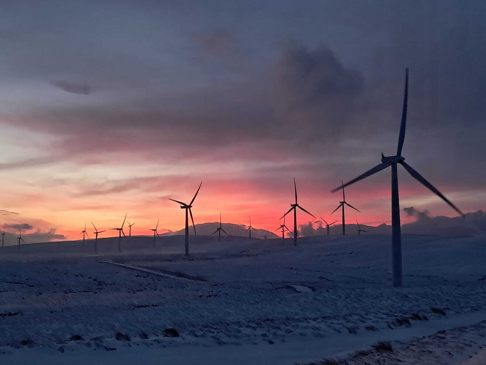
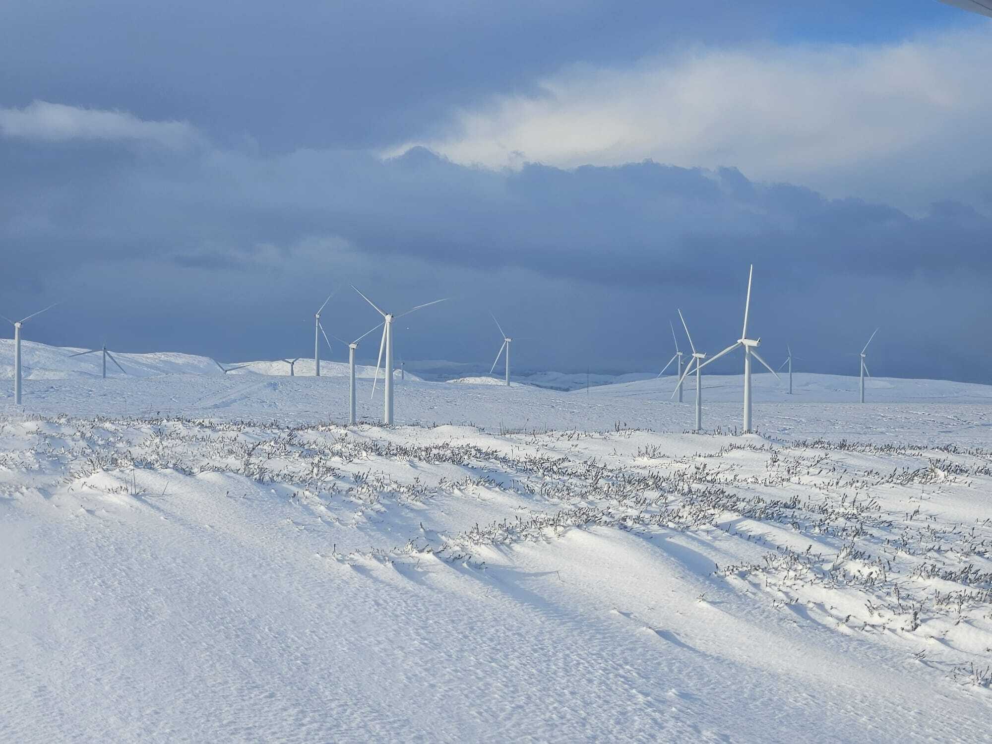
Farr Wind Farm is located 2.3 miles west from Farr village and over 3 miles from Tomatin in the east. The wind farm has been operational since 2005 and consists of 40 turbines, with a total installed capacity of 92MW.
Farr Wind Farm extension
We are exploring the potential to maximise the capacity at the site by extending the project to the north.
This could deliver an additional 67MW of renewable electricity - capable of powering an additional 55,283 UK homes, strengthening the UK’s energy security and contributing to our green power future.
Project proposal
- 10 additional turbines
- 200m tip height
- 67MW additional capacity
Project timeline
May 2026: Scoping submission
Summer 2026: Public consultation exhibitions
Winter 2026: Public consultation exhibitions
Spring 2027: Application submission
Spring 2028: Application determination
2030: Construction commences
2031: Project operational
Local impact
We believe that all our developments should deliver lasting, sustainable benefits.
We are committed to maximising the social and economic impact of the proposed Farr Wind Farm extension, building upon the legacy of the operational project and working with the communities closest to it to shape a community benefit package that reflects the real needs and priorities of those living and working locally.
Community benefit
We want to work with the local communities to learn from their experiences in delivering and managing the community benefit from Farr Wind Farm and other projects in the area, and let these experiences shape a package of benefits that reflects their needs and priorities.
We are committed to shared ownership and want to explore this with local residents. Elsewhere, we have worked with Energy4All to establish a cooperative structure, giving local people the opportunity to invest in the project and share directly in the financial returns.
With a longstanding track record of delivering meaningful community investment, should this project receive consent, we will work collaboratively to ensure that any benefit will make the greatest difference locally.
Economic benefit
We are committed to exploring all avenues to maximise the economic benefit.
- Priortising local employment and procurement at every stage of our developments - from construction through to long-term operation
- Working to support and encourage local businesses to tender for contracts, including electrical and building works, plant hire, fencing, catering and accommodation
- Supporting young people in building careers in renewable energy
- Exploring all avenues to maximise the economic benefit that our project can deliver locally
Useful Documents
Scoping Documents
-
Scoping Report Main Body FINAL FOR ISSUE
-
Figure 2 1 Site Location
-
Figure 3 1 Scoping Layout
-
Figure 7 1 Comparative Blade Tip and Hub Height ZTV within 45 km Study Area with Viewpoint Locations and Cumulative Context
-
Figure 7 2 Comparative Blade Tip and Hub Height ZTV within 20 km Study Area with Viewpoint Locations
-
Figure 7 3 Blade Tip ZTV with Forestry Excluded within 20 km Study Area including VP locations
-
Figure 7 4 Topography Map within 20km with Cumulative Context
-
Figure 7 5 Landscape Designations and Long Distance Recreational Routes within 45km
-
Figure 7 6 Landscape Character Types within 20 km
-
Figure 7 7 Landscape Designations and Long Distance recreational Routes within 20km
-
Figure 7 8 Representative Viewpoint 3 Balnafoich to the south of B861
-
Figure 7 9 Representative Viewpoint 5 A9 Daviot
-
Figure 7 10 Representative Viewpoint 11 Culloden Visitor Centre
-
Figure 7 11 Representative Viewpoint 13 Great Glen Way on the NE slope of Meall nah Eilrig
-
Figure 7 12 Representative Viewpoint 16 North Kessock Viewpoint
-
Figure 7 13 Representative Viewpoint 17 Great Glen Way north of Blackfold
-
Figure 8 1 Ornithology Study Area Desk Study Search for Designated Sites for Ornithology
-
Figure 8 2 Ornithology Study Area VP Survey Area
-
Figure 8 3 Ornithology Study Area Walkover Survey Areas
-
Figure 8 4 Baseline Environment Desk Study Search for Designated Sites for Ornithology
-
Figure 9 1 Designated Sites
-
Figure 10 1 Phase 1 Peat Depth Survey Results
-
Figure 11 1 AIL Delivery Route Option Overview
-
Figure 12 1 Cultural Heritage Study Areas
-
Figure 12 2 Nationally Important Heritage Assets
-
Figure 12 3 Category B and C Listed Buildings 5km Study Area
-
Figure 13 1 Operational Noise Study Area
-
Figure 18 1 Shadow Flicker Study Area
-
Scoping Report Main Body FINAL FOR ISSUE
Application Documents
Wind Farm Extension
-
Farr A5 Feedback Form ARTWORK
-
Farr Leaflet ARTWORK
-
Farr Brochure ARTWORK
-
Farr Ad 150x124
-
Farr A0 Boards ARTWORK 01
-
Farr A0 Boards ARTWORK 02
-
Farr A0 Boards ARTWORK 03
-
Farr A0 Boards ARTWORK 04
-
Farr A0 Boards ARTWORK 05
-
Farr A0 Boards ARTWORK 06
-
Farr A0 Boards ARTWORK 07
-
Farr A0 Boards ARTWORK 08
-
Farr A0 Boards ARTWORK 09
-
Farr A5 Feedback Form ARTWORK
Get in touch
If you would like to send us your thoughts or questions regarding the project, please fill out this contact form or send an email to farr@nadara.com
The information you provide here is collected solely to process your request regarding this project and will not be shared with third parties.
Feedback on the proposed extension
Thank you for taking the time to review our proposal for Farr Wind Farm Extension.
Please complete this feedback form to provide your comments on our plans.
Your views are important and will help to shape our proposals.
This form can also be downloaded and returned by post to:
Farr Wind Farm Extension
c/o Nadara
4th Floor, 12 Blenheim Place
Edinburgh
EH7 5JH
Alternatively, you can send it via email to: farr@nadara.com
The information you provide here is collected solely to process your request regarding this project and will not be shared with third parties.